Präzise Drohnenvermessung aus Dresden, für Sie
Hochwertige 3D-Modelle für Architekten, Planer, Gutachter, Sachverständige und Privatleute
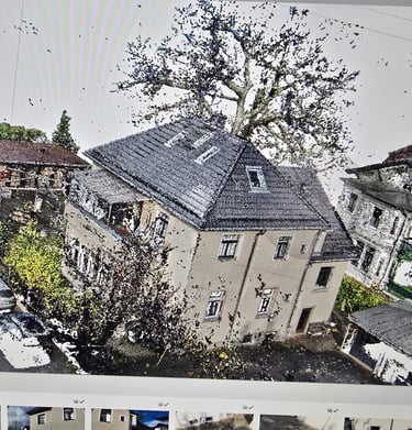
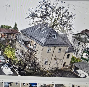
Präzision aus der Luft
Mit modernster Drohnentechnologie erstellen wir detailreiche 3D-Modelle, die Architekten und Planern den entscheidenden Vorteil bieten.


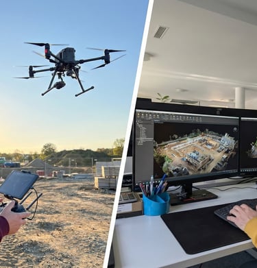
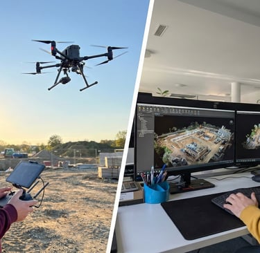
Unsere Leistungen
Präzise Drohnenvermessung und 3D-Modelle für Ihre Projekte.


Drohnenflüge
Sorgfältige Erfassung aus der Luft für exakte Daten.
3D-Modelle
Detailreiche Modelle zur Unterstützung Ihrer Planung.
Datenanalyse
Professionelle Auswertung für fundierte Entscheidungen.


Galerie
Beeindruckende 3D-Modelle aus präzisen Drohnenvermessungen.


Kontakt
Schnell erreichbar für Ihre Fragen und Anliegen.
Sebastian Janik
Alaunstraße 25a
01099 Dresden
Telefon
kontakt@projektservice-janik.com
+49 173 3266672
© 2025. All rights reserved.